Eastside Road, January 29, 2012—
 |
| Lindsey on the trail |
Today's hike — it was a bit too strenuous to be called merely a "walk" — took us through oak hillsides above Lake Sonoma, the artificial lake formed a number of years ago when one of the last of the Corps of Engineers dams was built in the great Northern California water project. We protested the building of Warm Springs Dam at the time, to a great extent because it interfered with local rights to the environment that had been in place long before the coming of Europeans to the continent. And I'm sure we had ethics on our side: but I wasn't so sure, yesterday, that I wasn't selfishly happy we'd lost the fight.
The Visitors Center at Warm Springs Dam is closed at the moment — for renovation, the sign proclaims, but in today's economy you never really know why these facilities close. But the Corps of Engineers, which apparently maintains not only the dam but also the fish hatchery at its foot, maintains its own headquarters across the road from the Center; there you can get trail maps, and advice, and I suppose news of any recent threatening activity: poison oak, rattlesnakes, for all I know cougars.
We drove up Skaggs Spring Road to the South Lake trailhead; only three or four other cars were there on a warm and sunny Sunday afternoon. The trail leaves from the south end of the parking lot. For the most part it's a one-man-wide trail cut into contours on the hillside, which drops steeply from Skaggs Spring Road down to the lake: you never come near the water, though the trail drops and climbs frequently, quartering the contours, crossing narrow freshets at times. It had rained last week, and the trail was soft underfoot, muddy near the freshets: we saw footprints of people, dogs, raccoons, pigs.
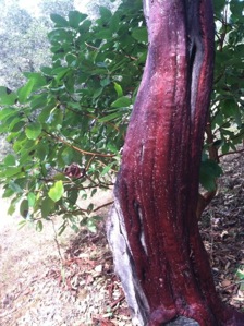
No animals to be seen, no birdsong. Soft air; fragrance — a sudden vanilla surprise, and the nearly constant scent of oak and duff. A few wildflowers — those tiny white ones we called filaree last weekend; and low-growing Baby Blue Eyes; and of course the magnificent madrone, some of them too in bloom.
Thanks to technology — MotionX-GPS on the iPhone — I can tell you we covered 4.84 miles in an hour and forty minutes, not counting rests, and that our altitude ranged from near 975 feet at the parking lot down to 650 feet, with a number of ups and downs along the way, for a total ascent of 943 feet, descent of 929. A good first workout for the year. Until July 27, you can see the map here.
1 comment:
Madrone. Manzanita. Arctostaphylos.
Good California stuff.
Scrub oak.
Premature Spring. Indian Summer.
We'll ruin the earth in due course.
But we'll be long under the lid by then, Charles.
It's nice to know someone has the time and opportunity to take day trips like this one.
We spent the weekend in our booth at the San Francisco Book Fair. Pat Curtan signed copies of her new book of menu designs. Gorgeous book.
Word verification: ranti.
Post a Comment